.svg)

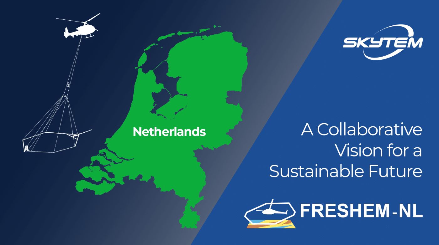
SkyTEM Embarks on Groundbreaking Groundwater Survey in the Netherlands
SkyTEM’s Knowledge Hub brings together research, project cases, and insights from our global work. Here you can explore peer-reviewed publications, technical papers, and field experiences that reflect our ongoing commitment to scientific integrity and innovation in airborne geophysics.
SkyTEM is thrilled to announce our collaboration with TNO and Deltares on the FRESHEM-NL project, a groundbreaking initiative aimed at mapping fresh and saline groundwater, as well as clay layers, across the Netherlands. This extensive helicopter electromagnetic (EM) geophysical survey will cover over 7,500 km², spanning seven Dutch provinces, including the Northern Region, the Noord-Holland region, and the Southern Region. The project encompasses a total of 24,000 line kilometers, targeting depths of 150 to 250 meters below the surface.
Addressing Critical Water Management Needs
The FRESHEM-NL project addresses the critical need for detailed subsurface data in coastal areas where fresh groundwater reserves are under increasing pressure from sea-level rise, climate change, and intensified water usage. Accurate mapping of the distribution of fresh and saline groundwater, along with the identification of clay layers, is essential for sustainable water management, agriculture, and environmental conservation.
Advanced Technology for High-Resolution Mapping
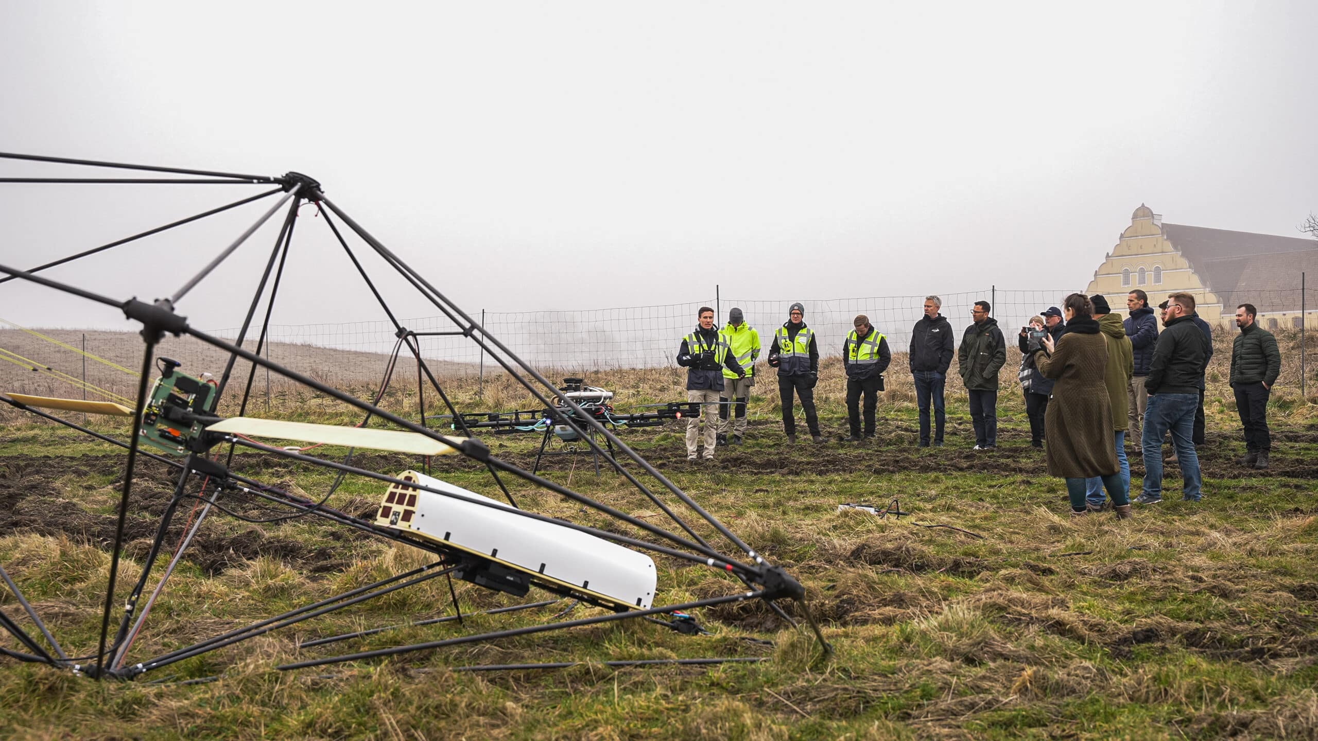
SkyTEM’s advanced helicopter-borne geophysical system is specifically designed for high-resolution mapping of subsurface features. Our technology is capable of distinguishing subtle variations in conductivity, enabling precise imaging of geological formations and groundwater distributions. This capability is crucial for making informed decisions related to groundwater extraction, contamination assessments, and infrastructure development.
Morten Melbye, CEO of SkyTEM, emphasized the significance of the project, stating: “Groundwater mapping is at the core of SkyTEM’s DNA. As a company based in Denmark, we are deeply aware of the challenges coastal areas face with groundwater resources due to climate change and rising sea levels. This project is especially important as fresh groundwater becomes an increasingly scarce resource globally. We are proud to bring our technology and expertise to the Netherlands to help address these pressing water management challenges.”
In this project, SkyTEM has partnered with EMergo from Italy, who will handle the advanced processing and inversion of the ultra-high-resolution geophysical data collected. This collaboration ensures that the data is interpreted with the highest level of accuracy, providing stakeholders with reliable information for effective groundwater management.
The data collected will be processed to create a comprehensive 3D model of the subsurface, revealing the spatial distribution of fresh and saline groundwater and the presence of clay layers. This model will serve as a valuable tool for water authorities, environmental agencies, and policymakers in making informed decisions about water resource management and environmental protection.
SkyTEM is committed to advancing geophysical exploration technologies to support sustainable management of natural resources. We are proud to contribute to the FRESHEM-NL project and look forward to the positive impact this initiative will have on the Netherlands’ water management strategies.
Water is life! Map it right the first time!
For more information about the project, visit the FRESHEM-NL website.
Discuss your project with a SkyTEM specialist.
We’ll help scope the right airborne electromagnetic survey for your goals and terrain.